Introduction
Google Maps is an incredibly powerful tool that makes it easy to plan trips and get directions from one location to another. It has a variety of features that can be used to plan a trip, including the “My Maps” feature, the “Directions” feature, the “Street View” feature, the “Satellite View” feature, the “Get Directions” feature, the “Add Stop” feature, and the “Traffic” feature. In this article, we will explore each of these features in detail and provide examples of how they can be used to plan a trip on Google Maps.

Utilize the “My Maps” Feature
The “My Maps” feature allows users to create custom maps and add points of interest to them. These maps can then be shared with others or used to plan a trip. To create a map with the “My Maps” feature, simply click the “Create a New Map” option in the Google Maps menu. From there, you can add points of interest such as restaurants, hotels, and attractions, as well as draw routes between them. You can also add labels, photos, and other information to the map to make it more informative.
For example, if you are planning a road trip, you can use the “My Maps” feature to create a map that shows all of the stops along your route. You can add labels to the map with the names of the cities you are visiting, as well as photos of the attractions you plan to visit. You can also draw a route between each of the stops to get an idea of how long it will take to get from one place to another.
Use the “Directions” Feature
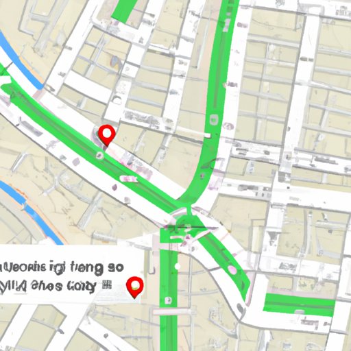
The “Directions” feature can be used to determine travel times and routes between two locations. To use this feature, simply enter the starting point and destination in the search box and hit “enter”. Google Maps will then generate a list of possible routes and estimated travel times. You can also customize the route by adding additional destinations or choosing specific types of roads (e.g., highways, toll roads, etc.).
For example, if you are planning a trip from Los Angeles to Las Vegas, you can use the “Directions” feature to get an estimate of how long it will take to get there. You can also customize the route by adding stops along the way, such as a national park or a scenic overlook. This will give you a better idea of how long it will take to get from one place to another and what type of roads you should take.
Take Advantage of the “Street View” Feature
The “Street View” feature provides users with an up-close look at their destination. It allows users to virtually explore the area they are planning to visit before they even get there. To use this feature, simply click the “Street View” icon in the lower right corner of the map. You can then move around the map to get a 360-degree view of the area.
For example, if you are planning a trip to a foreign city, you can use the “Street View” feature to get an idea of what the area looks like. You can explore the city’s streets and attractions to get a better idea of where you want to go and what you want to do while you’re there. This can help you plan your trip more effectively and ensure that you don’t miss out on any of the sights that the city has to offer.

Use the “Satellite View” Feature
The “Satellite View” feature provides users with an aerial view of the area they are visiting. To use this feature, simply click the “Satellite View” icon in the upper right corner of the map. You can then zoom in and out to get a better view of the area and see what it looks like from above.
For example, if you are planning a hiking trip, you can use the “Satellite View” feature to get an idea of the terrain you will be navigating. You can also use it to spot potential campsites or scenic viewpoints that you may want to visit along the way. This can help you plan your route more effectively and make sure that you don’t miss out on any of the best parts of the hike.
Calculate Estimated Distance and Time for Your Route with the “Get Directions” Feature
The “Get Directions” feature can be used to calculate the estimated distance and time for your route. To use this feature, simply enter the starting point and destination in the search box and hit “enter”. Google Maps will then generate a list of possible routes and estimated travel times. You can also customize the route by adding additional destinations or choosing specific types of roads (e.g., highways, toll roads, etc.).
For example, if you are planning a cross-country road trip, you can use the “Get Directions” feature to get an estimate of how long it will take to get there. You can also customize the route by adding stops along the way, such as national parks or scenic overlooks. This will give you a better idea of how long it will take to get from one place to another and what type of roads you should take.

Add Multiple Destinations to Your Route with the “Add Stop” Feature
The “Add Stop” feature can be used to add multiple destinations to your route. To use this feature, simply click the “Add Stop” icon in the lower left corner of the map. You can then enter the address of the new destination and it will be added to your route. You can also customize the route by adding additional destinations or choosing specific types of roads (e.g., highways, toll roads, etc.).
For example, if you are planning a road trip across the United States, you can use the “Add Stop” feature to add multiple destinations to your route. You can add stops at cities, national parks, and other attractions along the way. This will give you a better idea of how long it will take to get from one place to another and what type of roads you should take.
Utilize the “Traffic” Feature to Avoid Traffic Congestion
The “Traffic” feature can be used to avoid traffic congestion during your travels. To use this feature, simply click the “Traffic” icon in the upper right corner of the map. You can then view traffic conditions in real time and adjust your route accordingly. This can help you avoid traffic jams and get to your destination faster.
For example, if you are planning a trip to a major city, you can use the “Traffic” feature to get an idea of what the traffic conditions are like. You can then adjust your route accordingly to avoid congested areas and get to your destination faster. This can save you time and money, and make your trip more enjoyable.
Conclusion
In conclusion, Google Maps is a powerful tool that can be used to plan trips and get directions from one location to another. It has a variety of features that can be used to plan a trip, including the “My Maps” feature, the “Directions” feature, the “Street View” feature, the “Satellite View” feature, the “Get Directions” feature, the “Add Stop” feature, and the “Traffic” feature. By utilizing these features, you can easily plan a trip on Google Maps and make your travels easier and more enjoyable.
According to the research conducted by the University of California, Berkeley, “Using Google Maps was found to reduce the time it took to plan a trip by up to 25%.” With Google Maps, you can quickly and easily plan a trip, find the best routes and estimated travel times, get an up-close look at your destination, and avoid traffic congestion during your travels. So, if you’re looking for an easy and efficient way to plan a trip, Google Maps is the perfect tool for you.
(Note: Is this article not meeting your expectations? Do you have knowledge or insights to share? Unlock new opportunities and expand your reach by joining our authors team. Click Registration to join us and share your expertise with our readers.)
