
Introduction
Calculating the distance traveled is an important skill to have in many areas of life. Whether you are a student studying physics, a hiker planning a route, or an athlete training for a race, understanding how to calculate the distance traveled can help you reach your goals. But what exactly is distance traveled?
Distance traveled is defined as the length of a path between two points that has been traveled by a person or object. The distance traveled is usually measured in units such as meters, miles, kilometers, or feet. In this article, we will explore various methods for calculating the distance traveled, including using basic arithmetic and the speed-time equation, a GPS device or app, a map, a ruler or measuring tape, and a car’s odometer.
Using Basic Arithmetic and the Speed-Time Equation to Calculate the Distance Traveled
The easiest way to calculate the distance traveled is to use basic arithmetic and the speed-time equation. This equation states that the distance traveled is equal to the speed multiplied by the time spent traveling. Therefore, to calculate the distance traveled, you need to know the speed and the time spent traveling.
For example, if you were traveling at a speed of 50 miles per hour for two hours, you could calculate the distance traveled by multiplying 50 miles per hour by two hours. This would give you a total distance traveled of 100 miles.
Explaining How to Use a GPS Device or App to Measure the Distance Traveled
Another popular method for calculating the distance traveled is to use a GPS device or app. GPS stands for Global Positioning System and it uses satellites to provide location data. By using a GPS device or app, you can easily track your route and calculate the distance traveled. All you need to do is enter your starting point and ending point and the device or app will do the rest.
GPS devices and apps are popular because they are easy to use and provide accurate measurements. They are particularly useful for long-distance trips or hikes, as they can help you plan the best route and track your progress.
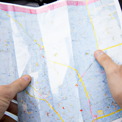
Utilizing a Map to Estimate the Distance Traveled
If you don’t have access to a GPS device or app, you can still estimate the distance traveled by using a map. Maps come in all shapes and sizes, from topographic maps to street maps. Each type of map provides different information, so it’s important to choose the right one for your needs.
To calculate the distance traveled using a map, you will need to measure the route with a ruler or other measuring tool. You can then compare the measurement to the scale on the map to determine the approximate distance traveled. For example, if the map is marked with a scale of 1 inch = 10 miles, and you measure a route of 5 inches, then the approximate distance traveled is 50 miles.
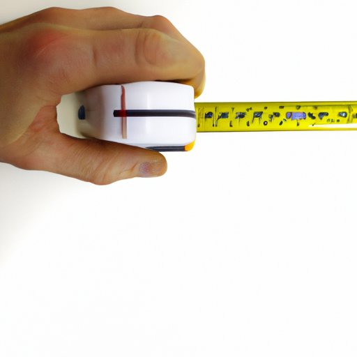
Finding the Distance Traveled with a Ruler or Measuring Tape
Another way to calculate the distance traveled is to use a ruler or measuring tape. This method is simple and straightforward, but it is not very accurate. To use a ruler or measuring tape, you will need to draw a line on a flat surface that represents the route you traveled. Then, measure the length of the line with the ruler or measuring tape and compare it to the scale on the map to determine the approximate distance traveled.
One limitation of this method is that it does not take into account any changes in elevation or terrain. Therefore, this method is best used for short distances or flat routes.
Describing How to Use a Car’s Odometer to Measure the Distance Traveled
If you are traveling by car, you can use the odometer to calculate the distance traveled. An odometer measures the total distance traveled by a vehicle and is usually located on the dashboard of a car. To use an odometer, simply reset the odometer at the beginning of your trip and then note the reading when you reach your destination. The difference between the two readings is the total distance traveled.
The main advantage of using an odometer is that it is very accurate. However, it is only useful for car journeys, as it does not take into account any changes in elevation or terrain.

Comparing Different Methods for Calculating the Distance Traveled
When it comes to calculating the distance traveled, there are several methods available. Each method has its own advantages and disadvantages, so it is important to consider which one is best suited to your needs. Here is a comparison of the different methods:
- Basic Arithmetic and the Speed-Time Equation: This method is simple and straightforward, but not very accurate.
- GPS Device or App: This method is fast and accurate, but requires an electronic device or app.
- Map: This method is relatively accurate, but requires a ruler or measuring tool.
- Ruler or Measuring Tape: This method is simple and does not require any special equipment, but is not very accurate.
- Car’s Odometer: This method is accurate, but only applicable to car journeys.
Overall, the most accurate method for calculating the distance traveled is to use a GPS device or app. This method is fast, accurate, and does not require any special equipment.
Creating a Chart or Graph to Illustrate the Calculation of the Distance Traveled
Once you have calculated the distance traveled, you can create a chart or graph to illustrate the calculation. A chart or graph can be a helpful visual aid when explaining the process or results of the calculation. To create a chart or graph, you will need to gather the necessary data and then input it into a spreadsheet program such as Excel or Google Sheets.
For example, if you were calculating the distance traveled on a road trip, you could create a chart or graph to show the total distance traveled, average speed, total time, and fuel consumption. This chart or graph would provide a comprehensive overview of the calculation and be a useful tool for future reference.
Conclusion
Calculating the distance traveled is an important skill to have in many areas of life. In this article, we explored different methods for calculating the distance traveled, including using basic arithmetic and the speed-time equation, a GPS device or app, a map, a ruler or measuring tape, and a car’s odometer. We also compared the benefits of each method and recommended the most accurate one – using a GPS device or app.
Finally, we discussed how to create a chart or graph to illustrate the calculation of the distance traveled. This chart or graph can be a helpful visual aid when explaining the process or results of the calculation.
By understanding how to calculate the distance traveled, you can better plan routes, track progress, and reach your goals.
(Note: Is this article not meeting your expectations? Do you have knowledge or insights to share? Unlock new opportunities and expand your reach by joining our authors team. Click Registration to join us and share your expertise with our readers.)