
Introduction
Geographers rely on technology to study and analyze Earth’s landscapes. From GIS mapping technology to remote sensing, GPS, 3D modeling, social media, and big data analytics, technology provides an array of tools that enable geographers to gain an in-depth understanding of the environment. In this article, we’ll explore how geographers use technology and the various applications of these tools.
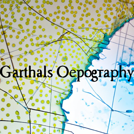
Exploring Geographic Data with GIS Mapping Technology
GIS (geographic information system) mapping technology is one of the primary tools used by geographers. GIS combines hardware, software, and data to capture, store, analyze, and visualize geographic information. It can be used to create detailed maps and graphics that illustrate the relationships between different elements of the environment such as land cover, population density, and climate.
What is GIS Mapping Technology?
GIS mapping systems are composed of three main components: hardware, software, and data. The hardware includes computers, scanners, and other electronic devices used to capture, process, and analyze data. The software is used to enter and manipulate data, create visuals, and generate reports. Finally, the data consists of geographic information such as aerial photographs, satellite images, and other types of spatial data.
How Does GIS Mapping Technology Help Geographers?
GIS mapping technology enables geographers to understand the physical characteristics of a landscape, the relationship between different elements of the environment, and the impact of human activities on the environment. For example, GIS can be used to map land cover, population density, and climate data, which can help geographers identify areas at risk of flooding or other natural disasters. GIS can also be used to track the spread of disease, analyze urban environments, and monitor environmental changes over time.
Examples of Applications of GIS Mapping Technology
Geographers use GIS mapping technology for a variety of purposes, including:
- Creating detailed topographical maps
- Analyzing the impact of human activities on the environment
- Tracking the spread of disease
- Monitoring changes in land use over time
- Identifying areas at risk of flooding or other natural disasters
Using Remote Sensing to Analyze Earth’s Landscapes
Remote sensing is another technology tool used by geographers. Remote sensing refers to the use of sensors to detect and measure aspects of the environment from a distance. These sensors can be mounted on satellites, aircraft, or drones, and they can collect data on a variety of parameters such as temperature, precipitation, vegetation, and land cover.
What is Remote Sensing?
Remote sensing is the practice of using sensors to observe the Earth from a distance. These sensors can be mounted on satellites, aircraft, or drones, and they can collect data on a variety of parameters such as temperature, precipitation, vegetation, and land cover. The data collected by remote sensing systems is then processed and analyzed to gain insights into the environment.
How Does Remote Sensing Help Geographers?
Remote sensing enables geographers to observe and analyze Earth’s landscapes from a distance. It can be used to track environmental changes over time, identify areas at risk of flooding or other natural disasters, and monitor the impact of human activities on the environment. It is also used to create detailed maps and graphics.
Examples of Applications of Remote Sensing
Geographers use remote sensing for a variety of purposes, including:
- Monitoring changes in land use over time
- Identifying areas at risk of flooding or other natural disasters
- Analyzing the impact of human activities on the environment
- “”A recent study by the University of California, Berkeley found that remote sensing can be used to identify areas where invasive species of plants and animals are likely to spread.”
- Tracking the spread of disease
- Creating detailed topographical maps
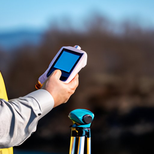
Utilizing GPS Technology for Surveying and Navigation
GPS (global positioning system) technology is another tool used by geographers. GPS uses a network of satellites to determine the location of a person or object on Earth. It is commonly used for navigation, but it can also be used for surveying and mapping.
What is GPS Technology?
GPS (Global Positioning System) is a satellite-based navigation system that uses a network of satellites to determine the location of a person or object on Earth. The system was developed by the U.S. Department of Defense in the 1970s, but it is now widely used for navigation, surveying, and mapping.
How Does GPS Technology Help Geographers?
GPS technology enables geographers to accurately measure distances, angles, and elevations. It can also be used to track movement over time, allowing geographers to observe and analyze changes in the environment. Additionally, GPS can be used to create detailed maps, which can help geographers identify areas at risk of flooding or other natural disasters.
Examples of Applications of GPS Technology
Geographers use GPS technology for a variety of purposes, including:
- Mapping terrain and creating detailed topographical maps
- Measuring distances, angles, and elevations
- Tracking movement over time
- Identifying areas at risk of flooding or other natural disasters
- Analyzing the impact of human activities on the environment
Applying 3D Modeling Tools to Understand Urban Environments
3D modeling tools are another type of technology used by geographers. These tools enable geographers to create 3D models of cities, buildings, and other aspects of the built environment. These models can provide valuable insights into the structure and function of urban environments.
What are 3D Modeling Tools?
3D modeling tools are computer programs used to create 3D models of cities, buildings, and other aspects of the built environment. These tools enable geographers to visualize the structure and function of urban environments in detail.
How Do 3D Modeling Tools Help Geographers?
3D modeling tools enable geographers to gain an in-depth understanding of the built environment. They can be used to analyze the impact of human activities on the environment, identify areas at risk of flooding or other natural disasters, and track changes in the built environment over time.
Examples of Applications of 3D Modeling Tools
Geographers use 3D modeling tools for a variety of purposes, including:
- Analyzing the impact of human activities on the environment
- Identifying areas at risk of flooding or other natural disasters
- Tracking changes in the built environment over time
- Creating detailed models of cities and buildings
- Analyzing the flow of traffic within cities
Leveraging Social Media Platforms to Collect Real-Time Geospatial Data
Social media platforms are increasingly being used by geographers to collect real-time geospatial data. By leveraging the power of these platforms, geographers can gain valuable insights into the environment and make informed decisions about how to best manage it.
What are Social Media Platforms?
Social media platforms are online services that enable users to share ideas, photos, videos, and other content with each other. Popular social media platforms include Facebook, Twitter, Instagram, and YouTube.
How Do Social Media Platforms Help Geographers?
Social media platforms provide geographers with an invaluable source of real-time geospatial data. For example, geographers can use social media to track changes in the environment over time, analyze the impact of human activities on the environment, and identify areas at risk of flooding or other natural disasters.
Examples of Applications of Social Media Platforms
Geographers use social media platforms for a variety of purposes, including:
- Tracking changes in the environment over time
- Analyzing the impact of human activities on the environment
- Identifying areas at risk of flooding or other natural disasters
- Monitoring the spread of disease
- Creating detailed maps and graphics
Integrating Big Data Analytics into Geographical Research
Big data analytics is another technology tool used by geographers. Big data analytics involves collecting and analyzing large amounts of data to gain insights into the environment. It can be used to identify patterns and correlations between different elements of the environment and make predictions about future trends.
What is Big Data Analytics?
Big data analytics is the process of collecting and analyzing large amounts of data to gain insights into the environment. It involves sorting through vast amounts of data to identify patterns and correlations between different elements of the environment, and making predictions about future trends.
How Does Big Data Analytics Help Geographers?
Big data analytics enables geographers to gain an in-depth understanding of the environment. It can be used to identify areas at risk of flooding or other natural disasters, analyze the impact of human activities on the environment, and make predictions about future trends.
Examples of Applications of Big Data Analytics
Geographers use big data analytics for a variety of purposes, including:
- Analyzing the impact of human activities on the environment
- Identifying areas at risk of flooding or other natural disasters
- Making predictions about future trends
- Tracking the spread of disease
- Creating detailed maps and graphics
Conclusion
Geographers use a wide range of technology tools to explore and analyze Earth’s landscapes. From GIS mapping technology to remote sensing, GPS, 3D modeling, social media, and big data analytics, technology provides an array of tools that enable geographers to gain an in-depth understanding of the environment. These tools enable geographers to identify areas at risk of flooding or other natural disasters, analyze the impact of human activities on the environment, and make predictions about future trends. The use of technology in geography has revolutionized the field, providing geographers with powerful tools to gain a better understanding of the world around them.
(Note: Is this article not meeting your expectations? Do you have knowledge or insights to share? Unlock new opportunities and expand your reach by joining our authors team. Click Registration to join us and share your expertise with our readers.)